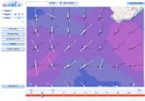
Zoomable wind and wave forecasts for sailors
High resolution forecasts for sailors, using smartphones, ipads, tablets, netbooks or note-books together with mobile connect usb sticks, or wlan in the harbour.
The highest amount of high quality forecast information
for the entire spectrum of available bandwidth from DSL, UMTS-Turbo HSDPA down to 25 kbits/s for Satellite telefones, by fully utilizing the given downloadrates.
With the best Usability and Performance
via taking the advantage of cutting edge Internet technologies
Geo-localisation:
Regardless of which Geo-wind version you will order, you will get your personalised Geo-Wind with the origin of your desired place, you have booked. Your geo-wind will allways start with your desired place, which is marked in the center of your personalised map area.Geo-localisation is not only used, to see your actual position on the map in relation to the moving wind fields and to search for any place on earth and each harbour. It is also used, to choose the right area of forecast data for your place. You need not to manually select and download the data, before you can see it
One View - one Click
The use of cutting edge internet technologies enables a never seen amount of forecast information visualised in one single display. In one viewyou can see:
- all the local forecasts up to 7 days ahead
- The forecast exactly for your place, which is marked on the map
- The forecast for the surrounding areas
- this all displayed on a zoomable map for the best geografical orientation
- for all weather parameters
- with sea wave and swell forecasts
- with one click to the region view, an overview of the weather situation and
You need not to click through several menus, before finding your place.
You need not to seek your position. It is automatically displayed on the map. .
You need not to click to another view, to see the weather map, because in the point forecast, you could not see the surrounding conditions. You see the forecast of your point inside the weathermap..
You need not to once more change to the geo-view (googlemaps), because you lost the geografical orientation. You see all, the point forecast and weathermap on top of a zoomable geografical map .
High performance animations at any zoomlevel
Once downloaded, you can play the forecast animation with high performance in any zoomlevel. The combination of zoomable maps with fast animations is the nature of the invention of Geo-wind.
Comfortable usability for professional High Quality Wind and Waveforecasts
Geo-wind enables the access to high quality wind and waveforecasts over the internet, which before was only accessible on desktop-P'C's, requiring the installation of a viewing software for grib data.
With Geo-wind also hobby sailors, renting a boat, have now access to that professional data quality, using smartphones, ipads, netbooks or notebooks together with mobile connect usb sticks, or wlan in the harbour.
Also the outdated procedure, to manual download the data before you can visualize it, is now vanquished.
All in one: Sailor forecasts and sea map
The wind and waveforecasts are displayed on a full-fledged zoomable map for best geografical orientation. We use Open street map.
- Geo-wind is available in different versions (forecast periods) and price categories (forecast data resolutions). Go to the Product page, to see informations about the versions, prices and which data resolutions are availble for which place on earth.
- Geo-wind is available as an app for almost all smartphones and Tablets and browserbased with Flash player 10.1. Go to technical requirements for more information.
